Back إيست نيوآرك (نيوجيرسي) Arabic ایست نیوارک، نیوجرسی AZB East Newark Catalan Ист-Ньюарк (Нью-Джерси) CE East Newark CEB East Newark, New Jersey Welsh East Newark German East Newark (Nueva Jersey) Spanish East Newark (New Jersey) Basque نیوآرک شرقی، نیوجرسی Persian
East Newark, New Jersey | |
|---|---|
 Erie-Lackawanna embankment | |
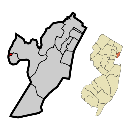
 Location of East Newark in Hudson County highlighted in red (left). Inset map: Location of Hudson County in New Jersey highlighted in orange (right). | |
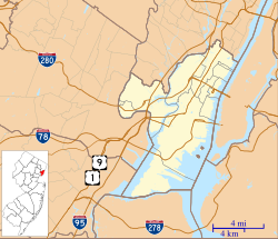
 Census Bureau map of East Newark, New Jersey | |
Location in Hudson County Location in New Jersey | |
| Coordinates: 40°45′07″N 74°09′44″W / 40.752011°N 74.162189°W[1][2] | |
| Country | |
| State | |
| County | |
| Incorporated | July 2, 1895 |
| Government | |
| • Type | Borough |
| • Body | Borough Council |
| • Mayor | Dina M. Grilo (D, term ends December 31, 2023)[3][4] |
| • Administrator | Robert Dowd[5] |
| • Municipal clerk | Kevin D. Harris[6] |
| Area | |
| • Total | 0.13 sq mi (0.32 km2) |
| • Land | 0.10 sq mi (0.27 km2) |
| • Water | 0.02 sq mi (0.06 km2) 16.92% |
| • Rank | 564th of 565 in state 12th of 12 in county[1] |
| Elevation | 16 ft (5 m) |
| Population | |
| • Total | 2,594 |
| • Estimate (2023)[11] | 2,428 |
| • Rank | 464th of 565 in state 12th of 12 in county[12] |
| • Density | 25,301.5/sq mi (9,769.0/km2) |
| • Rank | 6th of 565 in state 5th of 12 in county[12] |
| Time zone | UTC−05:00 (Eastern (EST)) |
| • Summer (DST) | UTC−04:00 (Eastern (EDT)) |
| ZIP Code | 07029[13] |
| Area code(s) | 973[14] |
| FIPS code | 3401719360[1][15][16] |
| GNIS feature ID | 0885199[1][17] |
| Website | www |
East Newark is a borough in the western part of Hudson County, in the U.S. state of New Jersey. It is a suburb of Newark, which sits across the Passaic River. The borough is the second-smallest municipality by total area in the state.[18]
The Borough of East Newark was established on July 2, 1895, from portions of Kearny lying between the Erie Railroad's Newark Branch right of way and Harrison, based on the results of a referendum held the previous day.[19][20][21]
As of the 2020 United States census, the borough's population was 2,594,[10] an increase of 188 (+7.8%) from the 2010 census count of 2,406,[22][23] which in turn reflected an increase of 29 (+1.2%) from the 2,377 counted in the 2000 census.[24]
- ^ a b c d 2019 Census Gazetteer Files: New Jersey Places, United States Census Bureau. Accessed July 1, 2020.
- ^ US Gazetteer files: 2010, 2000, and 1990, United States Census Bureau. Accessed September 4, 2014.
- ^ Cite error: The named reference
ElectedOfficialswas invoked but never defined (see the help page). - ^ 2023 New Jersey Mayors Directory, New Jersey Department of Community Affairs, updated February 8, 2023. Accessed February 10, 2023.
- ^ Borough Administrator, Borough of East Newark. Accessed May 22, 2022.
- ^ Clerk's Office, Borough of East Newark. Accessed May 22, 2022.
- ^ Cite error: The named reference
DataBookwas invoked but never defined (see the help page). - ^ "ArcGIS REST Services Directory". United States Census Bureau. Retrieved October 11, 2022.
- ^ U.S. Geological Survey Geographic Names Information System: Borough of East Newark, Geographic Names Information System. Accessed March 5, 2013.
- ^ a b Cite error: The named reference
LWD2020was invoked but never defined (see the help page). - ^ Cite error: The named reference
PopEstwas invoked but never defined (see the help page). - ^ a b Population Density by County and Municipality: New Jersey, 2020 and 2021, New Jersey Department of Labor and Workforce Development. Accessed March 1, 2023.
- ^ Look Up a ZIP Code for East Newark, NJ, United States Postal Service. Accessed June 29, 2012.
- ^ Area Code Lookup - NPA NXX for East Newark, NJ, Area-Codes.com. Accessed October 9, 2013.
- ^ U.S. Census website, United States Census Bureau. Accessed September 4, 2014.
- ^ Geographic Codes Lookup for New Jersey, Missouri Census Data Center. Accessed April 1, 2022.
- ^ US Board on Geographic Names, United States Geological Survey. Accessed September 4, 2014.
- ^ Astudillo, Carla. "The 10 tiniest towns in New Jersey (they're really small)", NJ Advance Media for NJ.com, November 1, 2016, updated May 16, 2019. Accessed March 5, 2020. "We used square mile data from the New Jersey Department of Environmental Protection to rank the ten municipalities with the smallest area size.... 2. East Newark - East Newark, a suburb of Newark in Hudson county, is the second-tiniest New Jersey municipality, making up about 0.113 square miles."
- ^ Snyder, John P. The Story of New Jersey's Civil Boundaries: 1606-1968, Bureau of Geology and Topography; Trenton, New Jersey; 1969. p. 146. Accessed June 29, 2012.
- ^ History Archived 2007-01-17 at the Wayback Machine, Borough of East Newark. Accessed June 29, 2012.
- ^ History of Harrison Archived 2017-09-17 at the Wayback Machine, Town of Harrison. Accessed September 16, 2017. "The Borough of East Newark was established by a vote of the citizens of the lower end of Kearny lying between the Erie Railroad and Harrison. Being dissatisfied with the existing town government, they voted on July 2, 1895, to separate following the example set by Kearny in separating from Harrison almost thirty years before."
- ^ Cite error: The named reference
Census2010was invoked but never defined (see the help page). - ^ Cite error: The named reference
LWD2010was invoked but never defined (see the help page). - ^ Table 7. Population for the Counties and Municipalities in New Jersey: 1990, 2000 and 2010, New Jersey Department of Labor and Workforce Development, February 2011. Accessed May 1, 2023.


